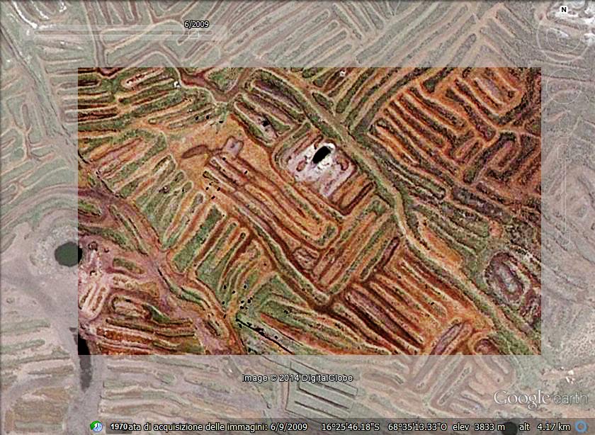
The image, obtained from Google Maps, shows the network of earthworks separated by canals - near the Titicaca Lake. This is an ancient agricultural technique used by Andean people starting from the first millennium BC.
More on Titicaca
arXiv:1009.4602 [pdf] Geoglyphs of Titicaca as an ancient example of graphic design,
Amelia Carolina Sparavigna
arXiv:1009.2231 [pdf] Symbolic landforms created by ancient earthworks near Lake Titicaca, Amelia Carolina Sparavigna
A.C. Sparavigna (2012)
Image Processing for the Enhancement of Satellite Imagery. In: Image Processing: Methods, Applications and Challenges / Vítor Hugo Carvalho. Nova Science Publishers, Inc. (USA), pp. 149-161. ISBN 9781620818442
Image Processing for the Enhancement of Satellite Imagery. In: Image Processing: Methods, Applications and Challenges / Vítor Hugo Carvalho. Nova Science Publishers, Inc. (USA), pp. 149-161. ISBN 9781620818442
| A.C. Sparavigna, R. Marazzato (2011) Using Geographic Information Systems to Increment the Knowledge of Cultural Landscapes. In: Smart Tech & Smart Innovation, La strada per costruire il futuro, Torino, 15-17 Novembre 2011. | ||
|

